Maiden Cliff, in Camden, ME, is a 1.7-mile loop that promises both a challenge and a reward. With its 731-foot elevation gain, the trail offers a moderate climb that feels just the right balance, not too easy, but not overwhelming either. It’s the kind of hike that invites you to push just a little, to feel the burn in your legs as you climb, but also to savor each moment along the way.
We started our hike from the Turnpike Drive trailhead, but the beauty of Maiden Cliff is that there are multiple ways to approach it. Whether you begin from Camden Hills State Park or here, the paths meet at the halfway point, giving you a chance to choose your route and shift your perspective. The forested trails weave a sense of peace as you walk, leading you closer to the summit where the views open up, the lake sprawling below, the forest stretching out in every direction. Maiden Cliff isn’t just a hike; it’s a reminder of the way nature asks you to meet it. With patience, determination, and a quiet openness to whatever it offers.

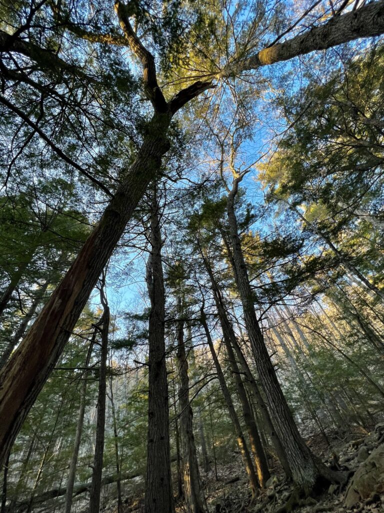
We arrived at the trailhead later than planned, with the sun already beginning to dip lower in the sky. The fading daylight reminded us that time was limited, so we started off at a steady pace. But even with the clock ticking, I couldn’t help but pause to take in the sounds of the forest, the gentle rustle of leaves, the soft gurgle of a stream winding alongside the trail. It was as though the forest itself was urging us to slow down and savor the moment, even as the day slipped away.
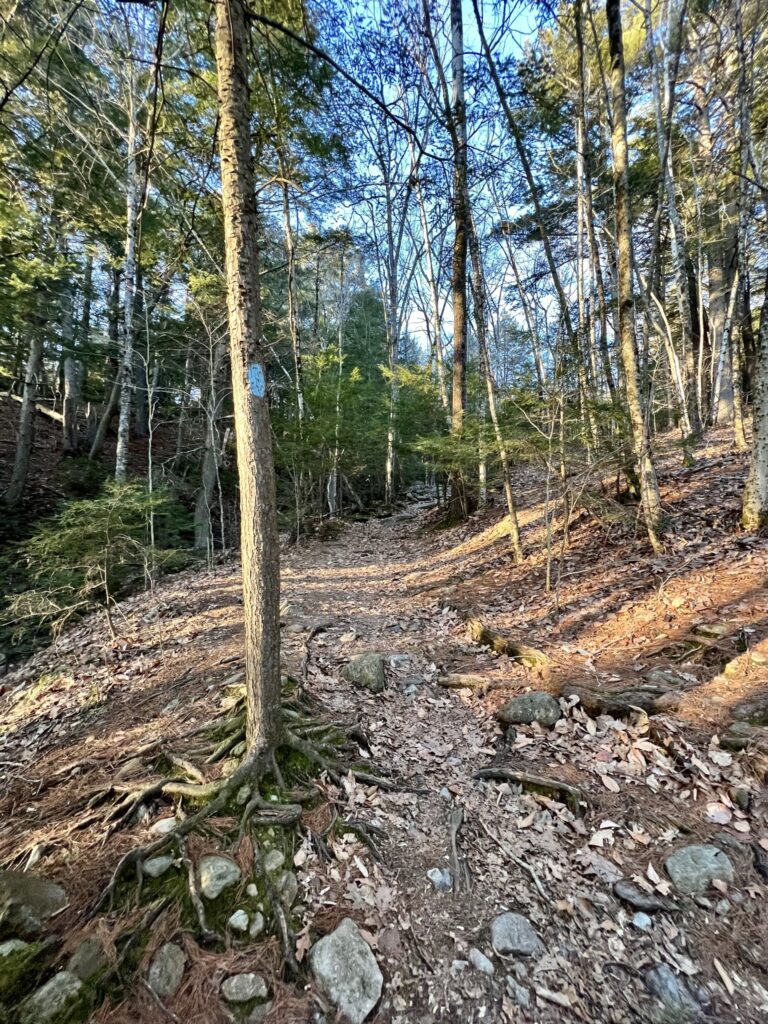
The stream stayed with us for a while, its waters threading through the trees, until we reached a split in the path. Here, a narrow bridge crossed the stream, and on the other side, signs of a recent storm became clear. Fallen trees and scattered debris had blocked the original trail, but a newly cleared path to the right offered a simple detour. Though the trail seemed untouched, it was easy enough to follow, and we continued on without hesitation.
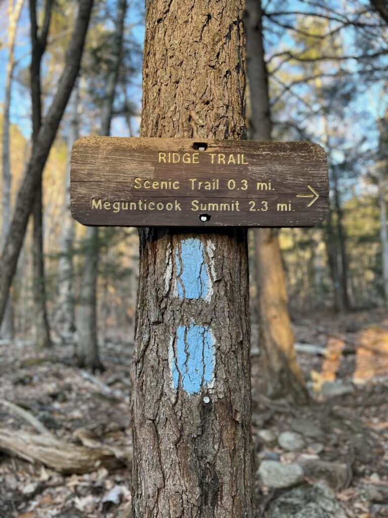
At the fork, we chose the Maiden Cliff Trail, hoping it would offer the quickest way to the summit. The goal was clear, catch the sunset from the top. In the moment, we thought we were picking the shorter route, but later realized that both trails were about the same distance. Still, the anticipation of reaching the summit before the sun sank below the horizon kept us moving forward, eager to catch that last golden light of the day.

As we continued our climb, the trail transformed, shifting from packed dirt to rugged, uneven rocks that seemed to form a natural staircase. The incline steepened, making each step a bit more challenging, but the golden light filtering through the trees kept us moving forward. The sunset bathed the landscape in a warm glow, casting the forest in a mix of amber tones and deep, stretching shadows. With every step, the anticipation built. We were close to the summit, and the thought of the view waiting for us kept our spirits high.
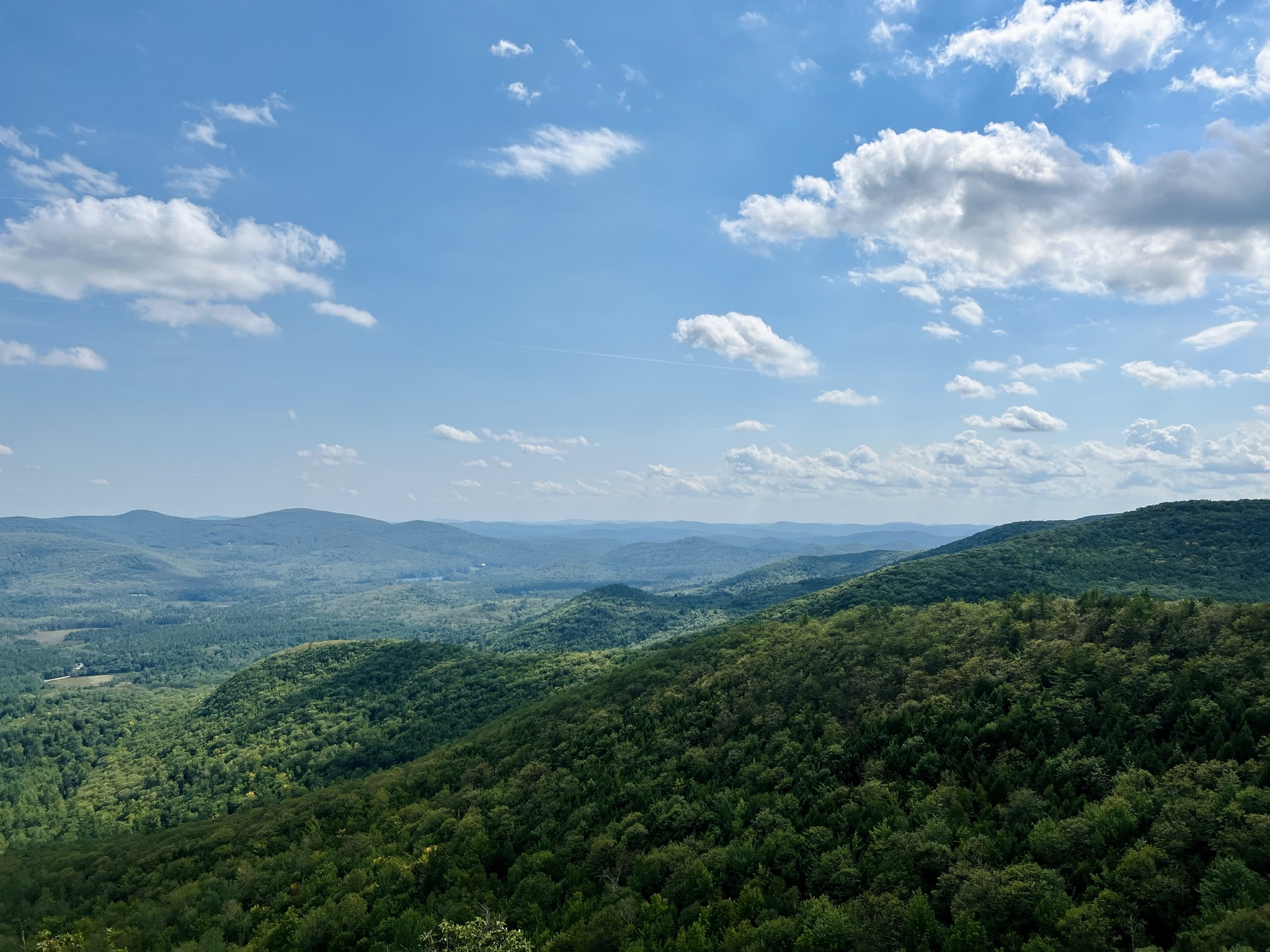
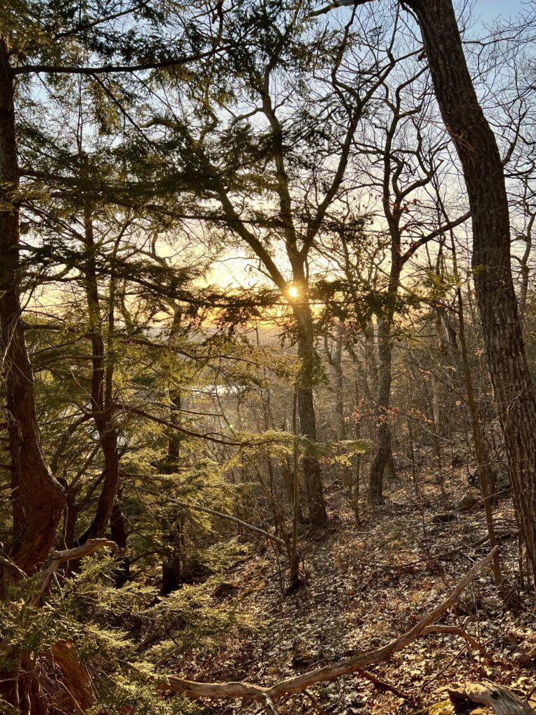
After navigating the rocky staircase, the trail leveled out briefly as it wound back into the woods. Some trees stood bare, their branches reaching skyward, while others still clung to their leaves, creating a beautiful contrast of textures. These open spaces and patches of woodland gave us fleeting glimpses of the lake and the distant mountains, each scene more breathtaking as the light faded. As we crested the final hill and rounded the last bend, the landscape before us unfurled. Most of the trees near the summit had shed their leaves, leaving an uninterrupted view of the sparkling lake below. Even before we reached the top, I could feel the magic of what was to come.

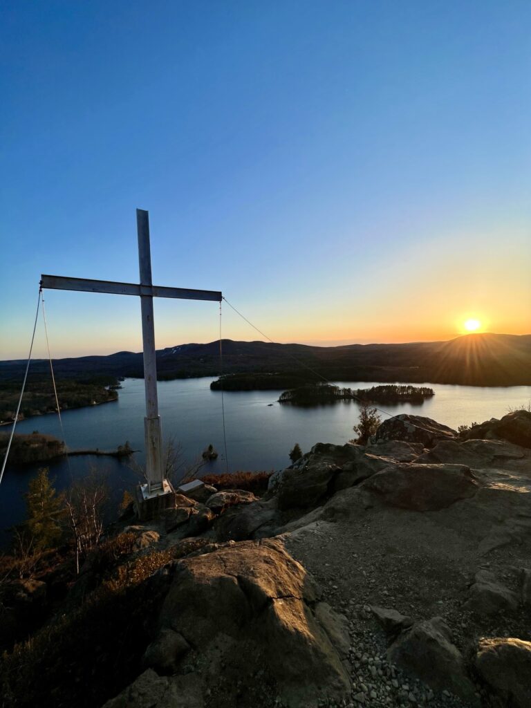
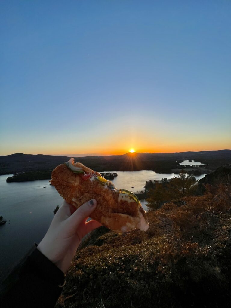
The trail led us to a breathtaking overlook, where we were greeted by sweeping views of Lake Megunticook and the Elenora French Cross. Above, the sky stretched out in a stunning ombre, transitioning from deep blue to soft pink and orange as the sun sank lower. Below, the lake’s glassy surface perfectly mirrored the sky, creating a scene so serene, it felt almost unreal. We found a quiet spot to sit, unwrapped our simple picnic (a Subway sandwich and a cookie) and let the moment wash over us. As we ate, we watched the sun dip behind the mountains, the sky deepening into richer shades of orange with each passing minute. In that stillness, I found myself wishing I could experience this view every evening.
We were so entranced by the sunset that we lost track of time. By the time we packed up and started our descent, the trail had darkened more than we expected, and we hadn’t brought flashlights. Fortunately, the soft glow from our phones was enough to guide us. The descent was quicker than the climb, and as we reached the car, the first stars began to twinkle in the night sky.
Reflections from the Trail
Hiking Maiden Cliff was an experience that will stay with me for a long time. The trail, with its blend of peaceful woods, rugged climbs, and sweeping views, was rewarding in every way. But more than that, it served as a reminder of how nature has a way of grounding us. Sitting at the summit, watching the last light of the day fade over Lake Megunticook, I felt a deep sense of stillness. As if time had slowed just for that moment.
Even though we stayed a little too long and found ourselves descending in the dark, I wouldn’t change a thing. From the quiet rustling of leaves on the way up to the golden glow of the sunset at the top, the entire journey embodied why I love these hikes. It’s not just about the views, it’s about the feeling of being present, of stepping away from the rush of daily life and reconnecting with something simpler, something real. Maiden Cliff reminded me that some of the most peaceful moments come when we least expect them, and I left that trail carrying a sense of calm that I know I can return to whenever I need it.
All the photos featured in this blog post were taken by me, unless otherwise noted.